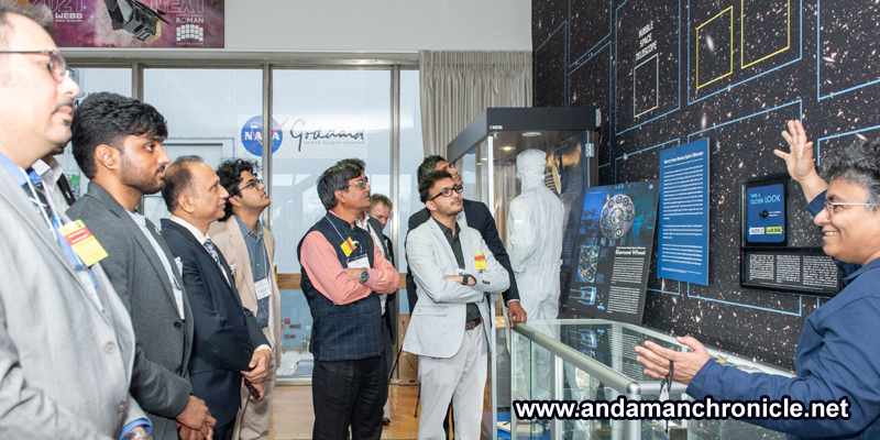
Kishan Thakkar’s IVLP experience shaped GalaxEye’s hybrid imaging satellite project, Mission Drishti, and fostered collaborations with U.S. companies.

GalaxEye co-founder Kishan Thakkar (fourth from left) at the Sciences and Exploration Directorate during a visit to NASA’s Goddard Space Flight Center as part of his IVLP program. The IVLP delegation included CEOs and technical directors from India’s private space sector. (Photograph courtesy NASA/Tabatha Luskey)
Driven by a vision to advance space technology, five alumni of the Indian Institute of Technology (IIT) Madras co-founded Bengaluru-based GalaxEye in 2021. The founders had previously collaborated as part of Team Avishkar Hyperloop, a student competition at IIT Madras, and qualified as the only Asian finalist in the 2019 SpaceX Hyperloop Competition . Their experience in innovation and global competitions helped shape GalaxEye’s mission to improve Earth imaging.
GalaxEye’s Mission Drishti is set to launch the world’s first hybrid imaging satellite, designed to offer high-resolution, all-weather, day-and-night imaging. Co-founder Kishan Thakkar’s participation in the 2024 International Visitor Leadership Program (IVLP) on U.S.-India Commercial Space Collaboration played a key role in advancing GalaxEye’s mission. The IVLP is the U.S. State Department’s premier professional exchange program that connects professionals with their counterparts in the United States through short-term visits.
As part of the IVLP exchange, Thakkar and eight other participants from India’s space sector engaged with U.S. counterparts to explore commercial space opportunities and foster collaboration. The group met with American space counterparts in Axiom Space , Viasat , NASA’s Goddard Space Flight Center , NASA’s Jet Propulsion Laboratory , the National Oceanic and Atmospheric Administration and the U.S. Department of Commerce . The program aimed to create opportunities for Indian and U.S. private space firms to network and identify areas for partnership.
Redefining earth observation
Mission Drishti is poised to boost various sectors by making satellite-based Earth observation a more reliable source of data by providing intuitive satellite imagery. “The satellite’s high-resolution imaging, using both optical and radar sensors, enables it to detect military camouflage, track troop movements, and provide surveillance in low-light conditions. It can also monitor crop growth, track urbanization, and detect changes in Earth’s surface,” explains Thakkar. The satellite’s data will support sectors such as maritime operations, defense, insurance, agriculture and utilities, helping drive informed decision-making.
IVLP takeaways
Thakkar describes his IVLP experience as highly valuable, facilitating interactions with U.S. government agencies, NASA, private companies, and organizations like Space Florida. “It gave me a deep understanding of how government-private collaborations function in the United States and how a similar approach could be applied in India,” he says. “I also identified potential avenues for GalaxEye to collaborate with U.S. companies.”
One of the key outcomes of these engagements was a formal agreement with Florida-based impulso.space , facilitating the transport of GalaxEye’s satellite for its upcoming U.S. launch. “I had the opportunity to meet their team at the SATELLITE Conference & Exhibition in Washington, D.C., shortly after the IVLP program,” says Thakkar.
GalaxEye has also benefited from valuable insights and technical support through its partnerships with the U.S.-based space company SpaceX. “They have provided valuable guidance, ensuring we are well-prepared for the launch with thorough documentation and consistent follow-ups,” Thakkar says.
Looking ahead
As GalaxEye prepares for Mission Drishti’s launch later this year, the company is set to introduce a major advancement in satellite imaging technology. Thakkar explains that this satellite will be the first to combine two types of imaging technology—radar and optical—to capture clearer, more detailed images of the Earth in any weather or lighting conditions. By enhancing Earth observation, it will play a pivotal role in supporting industries like defense, agriculture and disaster management.


